
❝ Do not Panic!
It's coming up to the anniversary of the 2009 Black Saturday Bushfires in February and the destructive force of the fire is still playing out on the landscape in 2016.
Before the fires
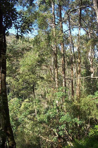
Ten years ago, three years before Black Saturday, I'd hiked up the hill you see in this top image, then dropped into the six hundred metre gulley and took the shots below. [1],[2] I treasure these images now. The forest may never be the same and you can see some of the last pre fire photographs of Strathewen.
I almost didn't get out.
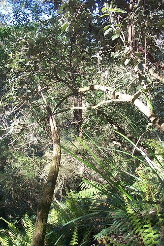
The Top
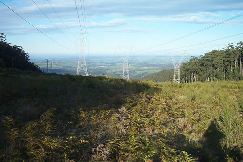
❝ 0724: Stop. Can feel exertion. Wind chill now obvious. Heard first whip bird. Finches & Pied Currajong. Can see city skyline and smog. Hear wind in trees. Can also hear the hum of the wires and occasional cow (even at this distance). Note the sun & glare has forced me to switch to KFF from beanie.
Spring, 2006. I decided one day at short notice to do a full day of hiking. I planned the day, checked out my kit, mapped the route, wrote down the destination instructions. Got up early one morning and left.
The winter rains have slowed, and less water at the creek line. I knew what to expect. I'd been there before. I had been on the move since five in the morning. Dawn was just breaking the hill line when started moving. I made my way slowly up the hill with my pack, up the steady incline. I got to the top and started descending just before half past seven in the morning. Looking at my diary entry on that day at the top.
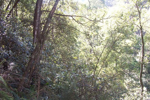
The Cutting
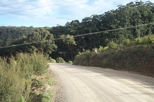
❝ Easy going and moving down the road to objective beta (b). Transmission lines overhead. At this distance the crackle of electricity can be overheard above the wind.
I was making my way down the hill towards a cutting. The cutting is at the corner of the road you see. It leads directly down to the creek line. First you have to navigate the descent.
The Entry
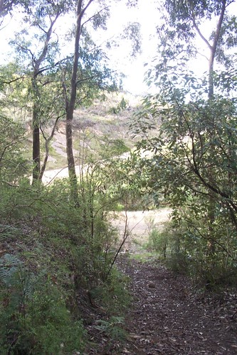
❝ Around 0810 Looking back to the road. Slight incline. Note the darkness compared to the outside (out of canopy).
Time to enter the bush and descend. It is darker here than outside. The camera struggles with the contrast.
The Descent
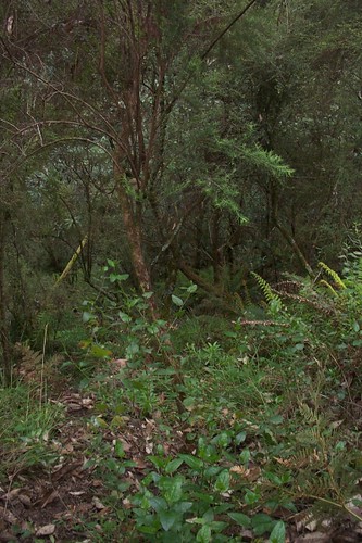
❝ 0842-0850: The ground looks stable but it is not. You have to pick your step carefully. I choose a tree & slowly make way for it. This way if I slip I'll hit a tree and stop.
I'm knee deep in leaf litter, bark and timber. It is a long way down and as I descend I grab what tree branches I can. I look out for snags. I do not want to twist or hyper-extend my knee going down.
Bottom
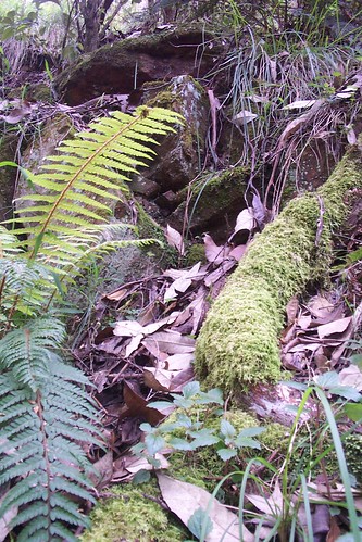
❝ 0842-0850 Typical of the undergrowth. Tree's with moss, leaves. Wood rotten and ferns surrounding the ground with ground and tree ferns above. Wet, slippery and dangerous.
Reached the bottom. I am knee deep here in leaf litter. Everywhere is up. Next the creek line.
The creek line
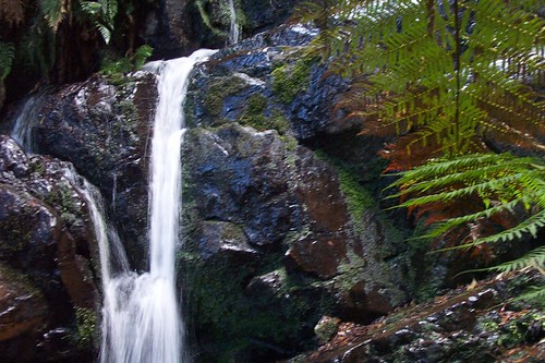
❝ 0905 Difficult area. Birds (flying) over water!
This is head waters of Arthurs Creek. Noisy, wet. All around me are rocks that are slimy and wet. I had to work hard to get down that fall. It was a lot more active than I last remember. I had no rope, so I moved around the fall and moved down. No way was I game enough to go down the rock face. I must have lost concentration here as It's here I was about to make a subtle mistake.
❝ At this point I should have panicked! I didn't. Instead, I sat down, made a cup of tea, took a few photographs and thought out my next move.
It is here I make a trivial mistake. I cross the creek and climb the opposite side to where I want to exit. I do not realise this until I have climbed twenty to thirty metres up.
A subtle mistake
❝ 0930 Rest. Sitting 30M above creekline. Slope 70 degrees plus. Sun breaking through over ridge plotting course to creek. Don't panic At this point I could have panicked! But I didn't. I sat down, then stood up (this is how I took the shots). Then sat down again and thought carefully before I did anything. This is important because i was a long way up, trees where sparse, the ground wet.
I realised I'd made a mistake when I got to here. I could not move forward. It was so steep, the only way to move forward was by lining up a tree and lunge towards it, grabbing on so I don't fall downwards. As soon as I realised this, I broke out the tea. I took this shot standing up. Look at the way the tree tops are below my feet. After I took a few shots, had some tea I had an idea, lets move up.
Looking down
❝ 0930 Looking down. This is where I want to be. But I have to traverse a big waterfall. So the only way was up. I cannot go down. The area is too steep and do not want to risk it having to get all the way down only to find I will have nothing to hold on to.
I cannot go down. How about up? One problem. Going up is also a problem. The soil is too soft, the trees are hanging over so I cannot reach up.
Look right
❝ 0930 Not much there. I have to aim for the trees, the thing in the centre. If I grab onto anything else it may break, I will slip and down the 20-30M I will go. So lets go up higher. But If I go higher... the farther I have to go down.
There is no way I can go this way. Up is the only way now. How?
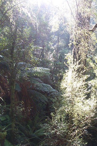
Looking back
❝ 0930 Looking back where I have come from. Steep country. What about straight ahead?
The one thing that strikes me, even now looking at these shots is the density of the forest. The undergrowth is blocking the light. It is early morning. Down below is dark.
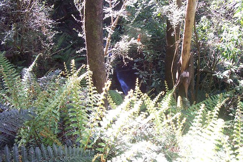
Straight ahead
❝ 0930 Straight ahead looking across the creek I spy where I was walking about an hour or two ago. Now to get back down into the creekbed without breaking my neck.
In the end I got out. I climbed up hill with the aid of some sticks. The only pieces of non rotten wood I could find. On my belly I grabbed one stick at a time, drove them into the soft earth above and kept doing this till I hit more solid earth. I keep them beside me at my desk to remind me of this situation. I eventually climbed high enough up the hill. Then descended to the creek floor.
Breakout
❝ Ridge line looking back to the summit. This view is from the valley floor. Road is to the right.
I found my way into a flat valley and slugged it through the hot dusty valley.
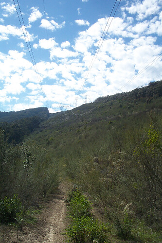
Climb to the road
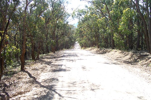
❝ Dusty Strathewen road, about 6 km from the summit.
I had to climb a rather steep incline. It was hard work in the heat. Finally made it out. Three years later this area was completely burned out. Everything you see in the above photographs is gone. The trees, the vegetation, the undergrowth, the wildlife, all burned out. These are some of the last images last images area around Strathewen and Bowden Spur Road pre fire.
Lessons
❝ The most important thing is I didn't panic, worked the situation and got out. I also got lucky.
I learned a lot in that couple of hours. Had I planned as well as I could? Did I really understand the terrain? What would have happened if I was stuck down the valley without communications? I also realised, even with the best planning, you can still get into trouble. The most important thing is I didn't panic, worked the situation and got out in one piece. I also got lucky.
I got out of the valley. I gained a new respect for the terrain.
Reference
[0] The view towards Melbourne in 2006. Taken on the Bowden Spur Road between Strathewen and Kinglake Central.
[1] You can find the original images I took here.
- https://www.flickr.com/photos/bootload/tags/lootbag
[2] The rough GPS co-ordinates are 37'51.9", 145'30.6".
- http://maps.google.com/?q=-37.519282690010634,145.3064203262329(2006SEP191515)&t=h
